


5 day tour from San Francisco perhaps towards wine country
 10-06-19, 04:21 PM
#1
Junior Member
Thread Starter
5 day tour from San Francisco perhaps towards wine country
We have a work-related trip to San Francisco planned for December so I am thinking of taking our BF tandem with us and doing ~5-day credit-card tour, about 50miles/day. I was looking into https://baytrail.org/ but it looks like it is still very much unconnected segments. Ideally, going towards Napa/Sonoma or Pacific seashore North of the city. Any route suggestions - definitely would like to avoid major busy roads.
 10-06-19, 05:23 PM
#2
Bike touring webrarian
One way into Sonoma is via the Russian River, which comes out at Highway One. You can ride north from SF, up through Bodega Bay (location of the movie The Birds) and turn right at Jenner. Then, following the Russian River inland you can make your way to Santa Rosa (a big town) and then down into Sonoma. Note that there are mountains between the Sonoma and Napa Valleys (that is why they are valleys!), so keep an eye on the elevations when you plan your route.
Riding north on the coast will be heading into the wind as the day progresses. Either ride early or prepare yourself mentally for the effort. In addition, while there is a vibrant biking community in both Napa and Sonoma, the bike routes are few. Also, there aren't all that many roads and many carry heavy traffic with limited shoulders.
Suggest you contact https://www.eaglecyclingclub.org/ for Napa information and https://www.srcc.com/ (Santa Rosa Cycling Club) for Sonoma.
10-09-19, 06:42 PM
#3
Full Member
Join Date: Mar 2015
Location: San Francisco
Posts: 280
Bikes: 2000 Santana Sovereign SE; 2005 Co-Motion Speedster; Kona Kilauea with various dorky commuter accoutrements; Mercier Kilo TT fixie; Burley Fladbed trailer for groceries, bags of cement and the like.
Likes: 0
Liked 90 Times
in
46 Posts
FWIW, SF resident here. My wife and I on our Co-Motion Speedster tandem have done a number 2-3 day loops from SF in wine country and along coast. We're 62, in average shape, and sometimes ride laden with touring/camping gear.
We find the best way from SF to get to Napa or back is to take the ferry from SF to Vallejo.
Here's a possible *very roughly described* route for you to look into, leaving a lot of detail out, including where to overnight (we always camp). I wouldn't hesitate to do it as a 5-day trip, especially if credit-carding:
-Ferry from SF to Vallejo (lovely 1-hour trip through Sf Bay)
-Vallejo to Napa (using ridewithgps, we did this a few weeks ago and it was busy some places but really fine)
-Napa to St. Helena (great scenery and mostly good cycle lane on Silverado Trail, though it can be a bit busy; avoid Rt 9 and 128)
-St. Helena back on Silverado Trail to Calistoga. Jimtown Store is cycling classic. If energetic, take a loop from Silverado Trail around Pope Valley and back.(loop described in book below)
-Calistoga to Geyserville then over to W. Dry Creek Road (lovely narrow paved road with little wineries; never busy the 3 times we've cycled it; two great loop routes in this area described in book below)
-W. Dry Creek Rd. to Westside Rd. to Healdsburg
-Back on Westside Rd to River Rd. to Guernville (stop at Korbel, buy bottle champagne, drink in garden!)
-Guernville to Pacific Coast Highway One just south of Jenner, then south to Bodega Bay (highway 1 can be busy but early morning on weekend we found it just fine)
OR
-Gurenville to Monte Rio then south on Bohemian Highway to Bodega Bay, mandatory stop bakery in Bodega on the way.
(we did a loop one day from Schoolhouse Canyon campground near Korbel to coast to Bodega Bay to Bodega then Bohemian to Guernville and ended up at Korbel for champagne. A fabulous mix of terrain and scenery.)
-Bodega Bay to Pt. Reyes Station (out to Pt. Reyes if you're energetic and don't mind headwinds.)
-Pt. Reyes Station to Stinson Beach to Muir Beach
-Muir Beach to Sausalito
-Sausalito to Golden Gate Bridge to SF (or take Ferry from Sausalito, but you really want to take GG Bridge)
For great routes in various sections, especially to avoid busy roads we have:
-Taken inspiration from this book: https://www.amazon.com/75-Classic-Ri.../dp/B00IUP9NPK
-Used a paper cycling map of the entire North Bay (don't have it with me now so don't know the maker) with good indications of incline/declines and routes
-Planned routes using ridewithgps.com app
-Checked out satellite views on Google maps
In any case, if a cupla oldsters like us can do it, you can too, with a little research, as none of us ride the same.
10-09-19, 09:22 PM
#4
Junior Member
Thread Starter
FWIW, SF resident here. My wife and I on our Co-Motion Speedster tandem have done a number 2-3 day loops from SF in wine country and along coast. We're 62, in average shape, and sometimes ride laden with touring/camping gear.
We find the best way from SF to get to Napa or back is to take the ferry from SF to Vallejo.
Here's a possible *very roughly described* route for you to look into, leaving a lot of detail out, including where to overnight (we always camp).
We find the best way from SF to get to Napa or back is to take the ferry from SF to Vallejo.
Here's a possible *very roughly described* route for you to look into, leaving a lot of detail out, including where to overnight (we always camp).
10-09-19, 11:57 PM
#5
Full Member
Join Date: Mar 2015
Location: San Francisco
Posts: 280
Bikes: 2000 Santana Sovereign SE; 2005 Co-Motion Speedster; Kona Kilauea with various dorky commuter accoutrements; Mercier Kilo TT fixie; Burley Fladbed trailer for groceries, bags of cement and the like.
Likes: 0
Liked 90 Times
in
46 Posts
The paper map I mentioned is the Krebs Cycle Products San Francisco Bay & Wine Country Bicycle Touring Map. We've used it so much I've put wide packing tape on it and just cut out the section we need for a given trip. It's an old-school bit put together by someone who clearly loves cycling.
Confession re the hills: I swapped out our 30T front chainring for a 24T granny, and switched to a 12-36 cassette. It means we can tackle about any hill on a route like this as long as we tell ourselves we're ascending at a hiking pace and in no hurry.
10-10-19, 06:21 AM
#6
Senior Member
Join Date: Aug 2010
Location: Madison, WI
Posts: 11,568
Bikes: 1961 Ideor, 1966 Perfekt 3 Speed AB Hub, 1994 Bridgestone MB-6, 2006 Airnimal Joey, 2009 Thorn Sherpa, 2013 Thorn Nomad MkII, 2015 VO Pass Hunter, 2017 Lynskey Backroad, 2017 Raleigh Gran Prix, 1980s Bianchi Mixte on a trainer. Others are now gone.
Liked 1,589 Times
in
1,230 Posts
I assume you are credit card touring. You said you were there for work but if part of your trip is on your own nickel, I found lodging costs in San Fransisco to be exhorbitant when I was there in 2014, but the HI Hostels were quite affordable. I stayed at the HI Fishermans Wharf Hostel. They can fill up, if you might stay there, reservations are best.
Likes For Tourist in MSN:
10-10-19, 09:10 PM
#7
Junior Member
Thread Starter
My only advice is to take the golden gate bridge, you will remember riding across it on a bike for the rest of your life.
I assume you are credit card touring. You said you were there for work but if part of your trip is on your own nickel, I found lodging costs in San Fransisco to be exhorbitant when I was there in 2014, but the HI Hostels were quite affordable. I stayed at the HI Fishermans Wharf Hostel. They can fill up, if you might stay there, reservations are best.
I assume you are credit card touring. You said you were there for work but if part of your trip is on your own nickel, I found lodging costs in San Fransisco to be exhorbitant when I was there in 2014, but the HI Hostels were quite affordable. I stayed at the HI Fishermans Wharf Hostel. They can fill up, if you might stay there, reservations are best.
10-11-19, 06:30 AM
#8
Senior Member
Join Date: Aug 2010
Location: Madison, WI
Posts: 11,568
Bikes: 1961 Ideor, 1966 Perfekt 3 Speed AB Hub, 1994 Bridgestone MB-6, 2006 Airnimal Joey, 2009 Thorn Sherpa, 2013 Thorn Nomad MkII, 2015 VO Pass Hunter, 2017 Lynskey Backroad, 2017 Raleigh Gran Prix, 1980s Bianchi Mixte on a trainer. Others are now gone.
Liked 1,589 Times
in
1,230 Posts
10-11-19, 07:10 AM
#9
Senior Member
When we packed super heavy for our first tour (Trans America) we pretty much maxed out the 50# limit on two bags each, but made it under the limit without needing to take a carry on. Since I converted to U/L touring with carefully selected U/L backpacking gear I can get bike and gear in one bag (a light soft case) and still stay under the 50# limit.
However you go have a great tour.
10-11-19, 07:32 AM
#10
OP: Better make sure things like KOA cabins offer more that a bare planform to sleep on. I am pretty sure they don't supply linens/blankets. Might consider a brining a sleeping bag and mattress.
 10-12-19, 08:15 AM
#11
Senior Member
Join Date: Aug 2010
Location: Madison, WI
Posts: 11,568
Bikes: 1961 Ideor, 1966 Perfekt 3 Speed AB Hub, 1994 Bridgestone MB-6, 2006 Airnimal Joey, 2009 Thorn Sherpa, 2013 Thorn Nomad MkII, 2015 VO Pass Hunter, 2017 Lynskey Backroad, 2017 Raleigh Gran Prix, 1980s Bianchi Mixte on a trainer. Others are now gone.
Liked 1,589 Times
in
1,230 Posts
Your own towel might come in handy too.
10-12-19, 12:51 PM
#12

climber has-been

Join Date: Dec 2004
Location: Palo Alto, CA
Posts: 7,532
Bikes: Scott Addict R1, Felt Z1
Liked 4,074 Times
in
2,008 Posts
When I was running my bike tour company, we operated a hilly tour in the region north of San Francisco.
It could be done as a credit card tour. Here's the daily itinerary:
Stage 1: Mill Valley-Occidental (63 mi., 4100')
Stage 2: Occidental-Timber Cove-Occidental ( 61 mi., 5500')
Stage 3: Occidental-Boonville (67 mi., 4200')
Stage 4: Boonville-Ukiah-Boonville (78 mi., 7100')
Stage 5: Boonville-Sea Ranch (54 mi., 5600')
Stage 6: Sea Ranch-Bodega Bay (69 mi., 6900')
Stage 7: Bodega Bay-Mill Valley (68 mi., 6100')
Stage 8: Mill Valley-Marin Headlands-Mill Valley (24 mi., 1900)
If anyone wants the routes, let me know.
__________________
Ride, Rest, Repeat. ROUVY: terrymorse

Ride, Rest, Repeat. ROUVY: terrymorse
11-05-19, 10:12 PM
#13
Junior Member
Thread Starter
Ok. We are set on the mini-tour following sapporoguy's route suggestions. 4.5 days starting with early afternoon ferry ride with tentative stops in Napa, Healdersburg, Bodega Bay and PT Reyes Station. A few more questions for locals:
-what is the typical day temp variation in Mid December. What is the chance of rain?
I like the idea of having an Uber as an emergency backup or to get to winery after day's ride is over. Is the whole area covered?
From reading the news Kincade Fire was going through very near the route. It is over but is there a reason to detour around the affected area or all back to normal in 5 weeks?
It seems that the route from Bodega Bay to Sausalito is all along hwy1... Is there a shoulder? Is it reasonable route to ride on. I see it is a part of the ACA Pacific route but still I remember that even driving on it felt dangerous.... Any alternatives?
11-06-19, 07:07 AM
#14
The Internets is full of weather/climate data. And Google Maps has something called Street View that shows roads. (CA-1 between the two referenced points seems to be primarily shoulderless. Take a look.)
11-06-19, 08:09 AM
#15
Senior Member
I agree--I certainly don't have any input to routes like the knowledgeable folks here, but I can say that riding across the GG 25 years ago was very cool to do, and a neat memory for me of my west coast trip.
11-06-19, 09:03 AM
#16
Bike touring webrarian
In December, it will be cold for this part of the world. As low as the low-40s in the morning. There may also be fog. If the sky is clear, there will be fabulous sunshine, though cool air during the day. If it is cloudy, it will be a bit cooler.
If you are unfortunate and it is a time of rain, it can be bad. Strong winds and rain all day, some of it hard. It is a bit of a crapshoot. If it makes any difference, we haven't had any rain (in SF) yet this year and the weather has been beautiful.
As mentioned above, Hwy 1 will have a narrow, if any, shoulder. You MUST ride with a mirror and be prepared to pull over when traffic dictates. If you don't normally ride with a mirror (why?), then you will be a fool not to get one for this ride.
As I mentioned previously, the wind comes from the north, especially in the afternoon near the coast. During storms, it comes from the south, usually. Best to get out early and be at your destination before the wind picks up.
This is a nice area to ride through. Be careful and have a great time.
11-06-19, 11:16 AM
#17
Hooked on Touring
Raybo is right. Cold & wet.
North - Napa - is wetter than south - San Juan Bautista.
Coastal - Santa Cruz is wetter than Inland - Rio Vista.
You don't even want to consider up north, Ukiah. (7.24 precip)
The interior valleys of the Coast Range are much drier, King City. (1.80 precip)
Depends on when the rainy season starts and how intense it is.
In an average year you may alternate between rainy and sunny days.
But the earth is refreshed and the hillsides a lush green.
A wet season may have torrential rains and mudslides.
A dry season may have significant closures due to fire risk and burn areas.
A loop out of Monterey might work - - might.
South along the coast - then to Mission San Antonio -
Then up the Salinas Valley and over to Pinnacles.
To San Juan Bautista and back to Monterey.
Limited services, some closed, but doable.
11-06-19, 03:27 PM
#18
Senior Member

A couple of years ago I rode south from SF to SLO in December. It was warm during the day and cold at night. Frost on the ground. Then the day I finished, it rained for three months, wiping out a couple bridges and causing a major landslide. And the day before I started, there were a couple days with 60 mph winds from the south. So, you may get lucky or not. I liked the hostel at Pigeon Point, which is a day’s ride from SF.
11-06-19, 03:44 PM
#19
Senior Member
I of course do not remember the "wheres" of these memories, but I certainly recall telling people afterwards of how the trip was challenging up and down wise, and sometimes traffic wise, specifically logging truck and tourist folks in rented RVs, not fully aware of their vehicles width and turn in around corners.....
11-06-19, 03:49 PM
#20
climber has-been
Join Date: Dec 2004
Location: Palo Alto, CA
Posts: 7,532
Bikes: Scott Addict R1, Felt Z1
Liked 4,074 Times
in
2,008 Posts
Always a chance of rain in December, especially near the Russian River. It can rain very hard. Santa Rosa averages 13 days of rain in December.
I don't think the fire will affect any services. The number of structures destroyed has been minimal.
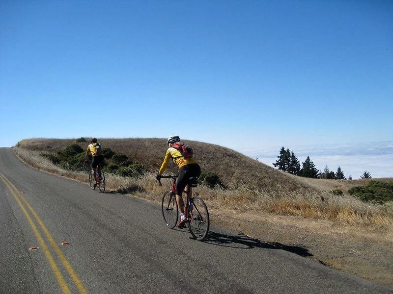
FYI, here's my route for the section between point Reyes Station and Sausalito, via Ridgecrest Road. On a clear day, the views on this route are grand.
__________________
Ride, Rest, Repeat. ROUVY: terrymorse
Ride, Rest, Repeat. ROUVY: terrymorse
